Thursday, June 23, 2016

Montrose, CO (6/20 - 6/22/2016)

Spoiler Alert: If you don't like sunsets or rainbows, you might want to close the blog right now, that's all I have for you since I haven't gone anywhere this week.

I've said before that Montrose is surrounded by mesas and buttes, as well as several mountain ranges.  One mesa, in particular, is located right at the western edge of town, in fact stopping the spread of town in that direction.  This very large, flat-top mesa is known as Sunset Mesa because it is the highest point in town and a great spot for viewing sunsets.  It has some houses, a large and very nice cemetery, several athletic fields and a fair amount of vacant land.  I go up there almost every night at the time for sunset and occasionally get some very good ones.  This week has had some interesting cloud formations that I think are worth sharing.

 When I arrived on Sunset Mesa Monday evening, I immediately noticed massive clouds over the Cimarron Ridge.  Those clouds picked up color as the sunset progressed.


 There were also powerful clouds over the San Juan Mountains, and they picked up some red color from the sunset.


From the cemetery, I had a pretty good view of the sun as it went down through a layer of clouds
.
Over Grand Mesa was a layer of nice clouds that picked up reflected light.


On Tuesday, a storm seemed to be brewing as I left my campsite.  On Sunset Mesa, I could see very dark clouds to the east and a rainbow forming across the valley.  At times, there was a part of a double rainbow, and the clouds became very bright from the setting sun.


Eventually a full arc of rainbow appeared amid the brightly colored clouds.  This was unlike any rainbow I had seen before.
Meanwhile, the sunset continued.


I was surprised Wednesday evening by the large lenticular clouds over the mountains.  These also picked up red color from the setting sun.

The actual sunset was also pretty good.
 

From these early experiences, I think I'm going to enjoy watching the Colorado sunsets, and I hope you do, too.

Tuesday, June 21, 2016

Yankee Boy Basin (6/20/2016)

Long-time readers will likely remember previous travelogues dealing with Yankee Boy Basin.  While I have been there numerous times, I never tire of the beauty I find there, and each season has its own rewards.  Right now, the current heat wave has snow melting rapidly, creating countless waterfalls and filling the streams.  This trip, I confess, was partly to escape the heat being felt down in the valleys.

The road to Yankee Boy Basin is called Camp Bird Road, named for one of the most prosperous mines in U.S. history, which in turn was apparently named for the gray jays that frequent the area and will steal lunch off your plate.  The road is always somewhat rough, but was much worse this time than I have ever seen it.  Snow plowing, recently completed, obviously does a lot of damage to the rocky, gravel road.  Further, all the water flowing down the mountains and crossing the road has created sizable washouts.  Road construction crews are already in place, but there is little point in filling washouts until the snow melt subsides.  Huge piles of rock and gravel wait alongside the road, waiting to go into road improvement.

Early on, the road is in pretty good shape, except for some washboard sections.


Almost everywhere you look, waterfalls are coursing down the mountains and filling the streams.


 Still, the mountains are the stars of the show, with their jagged edges standing out against the remaining snow fields.


The Camp Bird Mine was started in the late 1800's as a silver mine, but gold became its primary production over time.  In today's dollars, the mine has produced more than 1.5 billion dollars of ore. It has closed and re-opened several times over the years.  One of the early owners sold it for $5 million in 1907.  His daughter later bought the Hope Diamond for $180,000 when she was just 24 years old.  With gold prices at record levels in recent years, the mine was going to be re-opened in 2014, but financing failed.


One of the construction crews was working to repair the walls that support the road in many places.  One of the workers hangs over the canyon by rope to spray Shot Crete into forms.  It was surprising to see large cement trucks on the narrow road.  I can assure you, the cement truck cannot pass the overhang just beyond the work site.  I don't know how they get cement beyond this point.

Known for its wildflowers, the only ones showing now are dandelions.  Others will pop out soon.


More streams and waterfalls to enjoy.


The Revenue Mine was actually re-opened in recent years, but appears to have been abandoned once again.  The economy of nearby Ouray seems to always be on a roller coaster ride as mines open and close.


The old Atlas Mill, where ore was crushed, has long since fallen into ruins.

Closer to the 12,500 foot elevation of the basin, mountain views become more dominant.  In the next photo, you can clearly see two other roads in this area as they switchback up the mountains, one to Imogene Pass and the other to Governor Basin.  Both these roads are still closed by snow.


A view of the road as it enters the basin.  I neglected to make photos of the washouts and stream crossings, maybe because I was too busy negotiating them.

Twin Falls is one of the major locations for filming commercials when the wildflowers are in bloom.

Sneffels Creek can usually be crossed easily enough, but not at this time.


Friday, June 17, 2016

Owl Creek Pass & Cimarron, CO (6/15/2016)

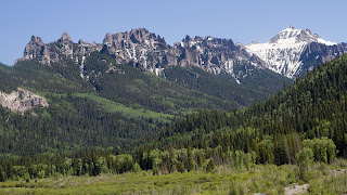
Once past the summit of Owl Creek Pass, the road heads north down the mountain to an area I refer to as "The Cimarron".  There are three forks of the Cimarron River (cleverly named West fork, Middle Fork and East Fork) flowing down the mountains and into Silver Jack Reservoir.  The Forest Service has provided numerous campsites in this area, many of them along a stream.  The outflow of the reservoir is known as Big Cimarron River, which flows into the Gunnison within 12-13 miles. 

This area is beautiful in summer because of the many wildflowers, but is truly spectacular in the fall when the aspens turn gold, orange and yellow.  The rugged mountains present dramatic backdrops in any season.


Any fork of the Cimarron River offers good fishing (I'm told) and pretty scenery.  But the mountains are by far my favorite subjects there.


With all the snowmelt being carried by the river right now, it is full of sediment that colors Silver Jack Reservoir a dull gray, rather than the sparkling blue we'll see later in the summer.


Wild lupines are blooming nicely along the road.


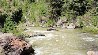
Look closely to see a fisherman along the bank of the Big Cimarron.


As I pass through ranch land, I stop to admire the gate to the Big Cimarron Ranch.


Rather than stay with Cimarron Road, which was only a short distance from the highway, I decided to explore a smaller road that also leads to the highway, but takes the scenic route.  This pleasant road led through smaller mountains and rolling hillsides, providing some nice views and large expanses of wild flowers.  In addition to the lupine, there were wild irises and arrow leaf balsam root.  This was a nice ending to a very enjoyable 40 mile drive through the mountains.